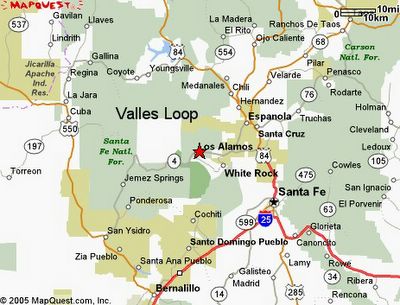
Here is a map of the "Valles Grande Loop" (pronounced Veye-yuh Gran-day in New Mexican Spanish). The darker green patch just south of Los Alamos is Bandalier National Mounument. The first picture in the series below is near White Rock and the rest go around the loop clockwise. The loop goes from Espanola, White Rock, Valles, San Ysidro, La Jara (pronounced La Hara), Coyote, and back to Espanola. The white square is the Valles and the soda dam is near Jemez Springs (hemez). Cabazon is west of 550 a little north of San Ysidro. The sediments picture is close to Cuba (east of 550). The next to last last pictures are between Galina and Coyote and north of the road.


0 Comments:
Post a Comment
<< Home