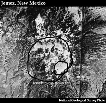
Here is a satellite photo of the Valles. The small loop is the area that can be seen from the road. The large circle is the whole caldera. At the bottom of the loop is the Jemez River breakout (marked). On the upper left of the caldera is the San Antonio River breakout. The two rivers meet near the "J" at the lower left of the caldera. The Soda Dam is also here. Several of the resurgent domes are clearly visible in the picture. The largest, just west of the small loop, is Redondo Peak. The photo is taken by the National Geological Survey.


0 Comments:
Post a Comment
<< Home